Sustainable Communities Partnership - Projects
Sustainable Communities Partnership (SCP) connects Western faculty and students with projects identified by community partners.
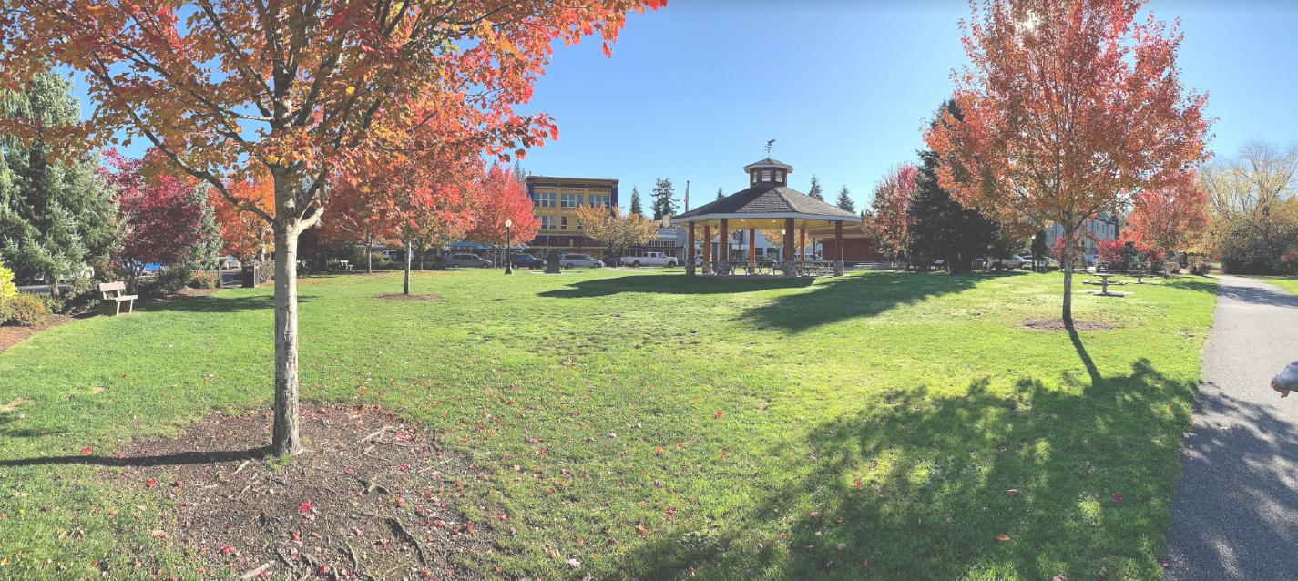
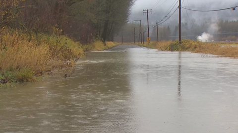
2022-23: Building climate resilience in rural areas, perspectives on safe and welcoming recreational opportunities, adapting to sea level rise, and understanding wildfire risk and extreme weather impacts.
In the 2022-23 academic year, SCP continued to work side-by-side with community partners on a variety of projects focused on building climate resilience in rural areas, perspectives on safe and welcoming recreational opportunities, adapting to sea level rise, and understanding wildfire risk and extreme weather impacts.
Learn more about these projects, see photos, and download reports by expanding the sections below.
Dr. Kate Darby and ENVS 467 students, East Whatcom Regional Resource Center (EWRRC)
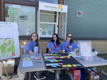
In spring of 2023, WWU students in Dr. Kate Darby’s ENVS 467 course, “Power, Privilege, and the Environment” worked with East Whatcom Regional Resource Center (EWRRC) to better understand Columbia Valley residents’ perspectives on local recreational opportunities and safety. Students engaged with community members through tabling at the local community center and a wellness fair. Check out their results in the report coming soon and their informative website.
Jonah Stinson and ENVS 476 students, City of Bellingham, Bellingham Office of Emergency Management, and Whatcom Community Emergency Response Team (CERT)
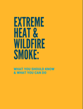
Students in the Disaster Reduction and Emergency Planning Studio (ENVS 476) in spring quarter of 2023 collaborated with the City of Bellingham, Bellingham Office of Emergency Management, and Whatcom CERT to develop a volunteer-based home check-in program that supports door-to-door life safety health check-ups and provides educational tips during heat events. To support this program design, students reviewed Whatcom CERT’s existing program infrastructure, performed an analysis of vulnerable populations within the city of Bellingham and conducted an inventory of current cooling capacity infrastructure within city limits.
Extreme Heat & Smoke Physical Handout
Digital Extreme Heat & Wildfire Smoke Booklet For Website
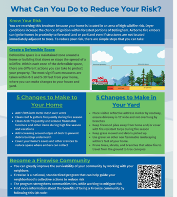
Jonah Stinson and ENVS 476 students, City of Bellingham, Whatcom and Skagit Conservation Districts, Bellingham Office of Emergency Management
Wildfires have historically occurred throughout Western Washington’s coastal environments. With incremental changes in climate and regional environmental and atmospheric conditions, the frequency, intensity, and duration of these incidents will likely transform. Students in the Disaster Reduction and Emergency Planning Studio (ENVS 476) in spring quarter of 2023 collaborated with the City of Bellingham, Bellingham Office of Emergency Management, and Whatcom and Skagit Conservation Districts to design an educational mailer for homes in Bellingham with high wildfire risk. Students were also trained in existing Firewise Program evaluation criteria for wildfire risk assessments and conduct neighborhood-focused door-to-door property assessments in the Whatcom Falls and Cornwall Park neighborhoods within the city of Bellingham.
Dr. Tammi Laninga and UEPP 374 students, City of Anacortes, Town of La Conner, City of Burlington, City of Sedro-Woolley, City of Mount Vernon
In spring quarter of 2023, students in Dr. Tammi Laninga’s UEPP 374 “Land Use Regulation and Technical Writing” course supported climate change and resilience planning through partnership with the Skagit Council of Government’s (SCOG) Growth Management Act Technical Advisory Committee (GMATAC). Students also worked side-by-side with planners and representatives from the City of Anacortes, Town of La Conner, City of Burlington, City of Sedro-Woolley, and City of Mount Vernon. Through research and discussions with partners, students suggested mitigation measures (e.g., policies that would reduce greenhouse gas emissions) and adaptation strategies (e.g., requiring fire-resistant siding on new construction) that could be incorporated into comprehensive plans.
Dr. James Miller, Dr. Nicholas Zafaretos, Dr. Tammi Laninga, and WWU's Urban Transition Studio students (UEPP 470, UEPP 472, UEPP 473), Lummi Commercial Company, and Lummi Nation Planning Department
WWU’s Urban Transitions Studio (UTS) collaborated with the Lummi Commercial Company (LCC) and the Lummi Nation Planning Department to complete a study and masterplan for Fisherman’s Cove area, located at Gooseberry Point on the Lummi Nation’s reservation. The UTS is a three-quarter long studio for senior undergraduate students in the Urban Planning & Sustainable Development (UPSD) major. Students performed research in teams, presented their findings to partners, and implemented feedback throughout the academic year. Fall/winter 2023 and Spring report can be found below.
2021-22 Partners: East Whatcom Regional Resource Center and East Whatcom Community Council Clean Air Committee, Washington State Department of Natural Resources, Concrete Resource Coalition, and Mt. Baker Snow School
In the 2021-22 academic year, SCP worked with over five community partners and several undergraduate students to understand issues related to climate resilience and community well-being in the North Puget Sound region.
-Dr. Kate Darby and ENVS 467 students, East Whatcom Regional Resource Center (EWRRC), and the East Whatcom Community Council Clean Air Committee
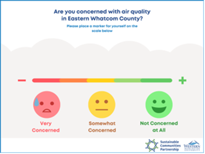
In spring of 2022, WWU students in Dr. Kate Darby’s ENVS 467 course, “Power, Privilege, and the Environment” worked with East Whatcom Regional Resource Center (EWRRC) and East Whatcom Community Council Clean Air Committee to better understand residents’ concerns about air quality in the Columbia Valley region (located in eastern Whatcom County). Recently, Columbia Valley residents have faced a variety of environmental challenges related to climate change, including worsening air quality brought on by wildfires and household stove use during power outages. Students and partners hosted several pop-up tabling events at popular locations throughout the valley. These events provided insights for designing future collaborative projects to support the Columbia Valley and its efforts to make their region and community more climate resilient. Please see the final report following this link .
– Dr. Craig Dunn and ENVS 466 students and Washington State Department of Natural Resources
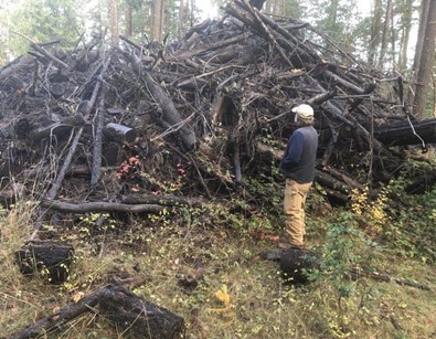
Earlier this year, Washington state’s Department of Natural Resources (DNR) and WWU students from Dr. Craig Dunn’s ENVS 466 course, “Greening Business Applications” partnered on a business feasibility study for a 160-acre plot near Kendall, WA. The students reviewed and compared two sustainability-focused business activities in this study: cogeneration (cogen) and biochar. Both activities would make use of a large quantity of small, unmerchantable, trees and branches left over from the timber harvesting process. The students performed market research and potential for both activities, determined a marketing and sales strategy, and performed a competitive analysis. Their results were inconclusive, and it was determined that more research was required to make a well-informed decision at this time.
To see a summarized report click the following link here
– Dr. Aquila Flower and the Concrete Resource Coalition
Climate change is already impacting the health of communities in a variety of ways across the United States, including human health impacts from extreme weather events such as storms and floods, and heat waves. Recognizing the connection between building climate resilience and community well-being, students in Dr. Aquila Flower’s “Advanced GIS Applications” course (ENVS 421) worked with the Concrete Resource Coalition to identify and map community assets and environmental hazards in the upriver region of Skagit County, near Concrete, WA.
– Dr. Kate Darby, Sarah Quenemoen (WWU undergraduate student), members of the farming community in Whatcom County
In 2021, Whatcom County farmers faced two significant extreme weather events: the heat dome in June 2021 and the large flooding event(s) starting in November 2021. Following these two events, a student (Sarah Quenemoen) under the guidance of Dr. Kate Darby initiated a research project to better understand how the agricultural sector in Whatcom County has been supported through these challenging events. Quenemoen hosted a focus group with small-scale, organic farmers in Whatcom County. Despite good practices in focus group outreach and recruitment, attendance was quite low. It is believed that a combination of COVID-19 impacts and spring timing, when farmers were busy preparing for their growing seasons, affected attendance. The limited participants of the focus group did offer some suggestions for support areas, including facilitating conversations about climate resilience, fostering relationships between farmers and community members, and developing infrastructure to support climate resilience. WWU’s Sustainable Communities Partnership (SCP) is eager to pick up where this research left off and engage the farming community in Whatcom County in the future.
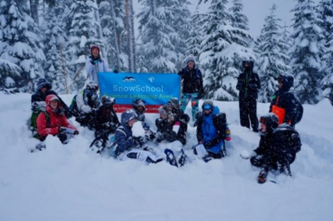
– Dr. Robin Kodner, Northwest Avalanche Center (NWAC), Mt. Baker Ski Area, Western Washington University (WWU)’s Living Snow Project (LSP), U.S. Forest Service
Mt. Baker Snow School is an outdoor winter learning adventure combining applied science education with snowshoe-powered exploration. Middle and high school students and their teachers engage in research and hands-on learning around the themes of weather, watersheds, and climate. This past winter, the program served 280 students from four different schools in Whatcom County, WA. These schools are in underserved communities with over half of the students receiving free or reduced lunches. The Snow School curriculum was updated in partnership with SCP staff to further enrich climate change related learning. Using the concept that warming temperatures increase the abundance of snow algae, students learned how a reduction in albedo leads to an increase in early season snowmelt. They further learned how that impacts streamflow in our local Nooksack River, leading to an increase in the severity of spring floods and summer drought. Over the next year, SCP will continue to support Snow School.
2020-2021 Partners: Columbia Valley Park and Recreation District and Whatcom County
In the 2020/2021 academic year, we are partnering with the Columbia Valley Park and Recreation District and Whatcom County. Two courses and a WWU graduate student intern are engaging in efforts to address sustainability needs, as expressed by these partners, and climate action.
Columbia Valley Park and Recreation District (CVPRD)
CVPRD Comprehensive Park Plan
During the period of summer 2020-January 2021, Sustainable Communities Partnership (SCP) partnered with the Columbia Valley Park and Recreation District (CVPRD) in East Whatcom County. Through this partnership, students in Dr. Tammi Laninga’s fall quarter Community Development and Participatory Methods course (ENVS 475) conducted a (remote) public engagement campaign in Columbia Valley, and graduate student, Sarah Parker, worked with the CVPRD commissioners to compile a Comprehensive Park Plan. This partnership was supported by a grant from First Federal Community Foundation.
Columbia Valley Park and Recreation District Project Report Comprehensive Park Plan
Whatcom County
Building Climate Resilience through GMA Comprehensive Planning
During the 2020-21 academic year, Whatcom County partnered with SCP to support consistent and coordinated climate planning across jurisdictional boundaries within Whatcom County. This partnership, with staff support from the Port of Bellingham and the City of Bellingham, formed the collaborative Building Community Resilience Project (BCRP) to support Whatcom County Small Cities, including Blaine, Everson, Ferndale, Lynden, and Nooksack, in climate planning efforts. Specifically, students recommended climate change goals, policies, and objectives to be adopted into various elements of the Small Cities’ Growth Management Act (GMA) comprehensive plans. Throughout this project, SCP supported the participating jurisdictions by performing climate impact, mitigation and adaptation research, providing direct support to city staff, and drafting customized GMA policy proposals for each city.
2019-2020 Partners: City of Arlington and City of Bainbridge Island
Over the 2019-2020 academic year, SCP partnered with the city of Arlington and the city of Bainbridge Island. Six courses and two interns engaged in efforts to address sustainability needs expressed by these cities.
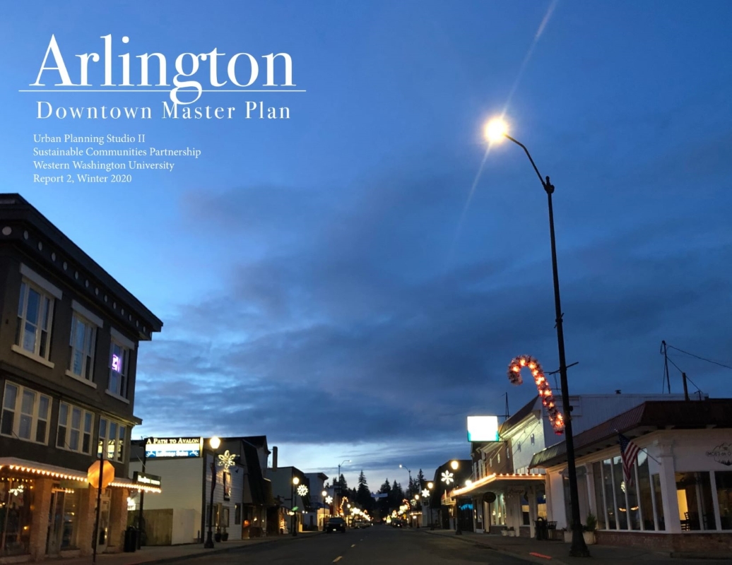
City of Arlington
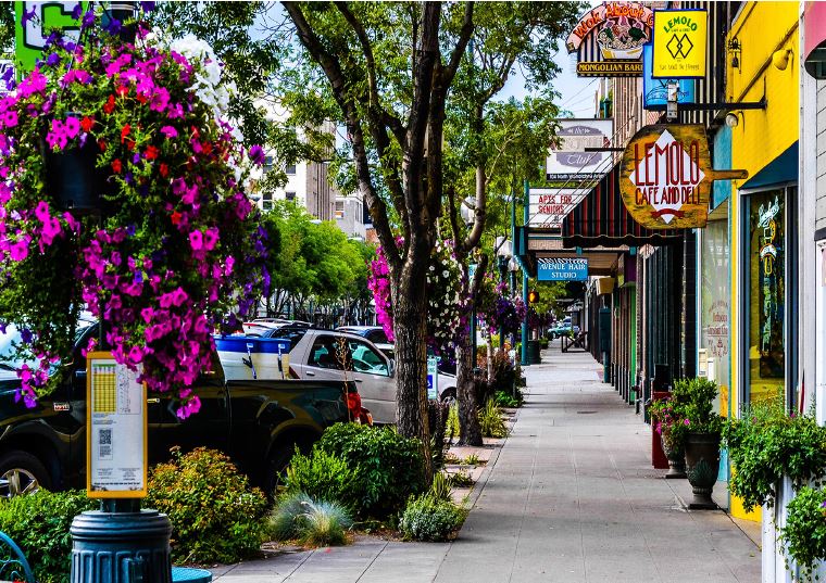
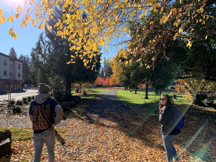
Also in Dr. Tamara Laninga’s Community Development & Participatory Methods course (ENVS 475), students worked with the city of Arlington to explore ways to better connect the Centennial Trail with the businesses, services, and amenities that exist within Arlington’s historic downtown. Specifically, the team completed case studies and collected input from the public to develop conceptual designs and recommendations for how the City can integrate the trail into its downtown.
Also in Dr. Tamara Laninga’s Community Development & Participatory Methods course (ENVS 475), students worked with the city of Arlington to explore ways to better connect the Centennial Trail with the businesses, services, and amenities that exist within Arlington’s historic downtown. Specifically, the team completed case studies and collected input from the public to develop conceptual designs and recommendations for how the City can integrate the trail into its downtown.
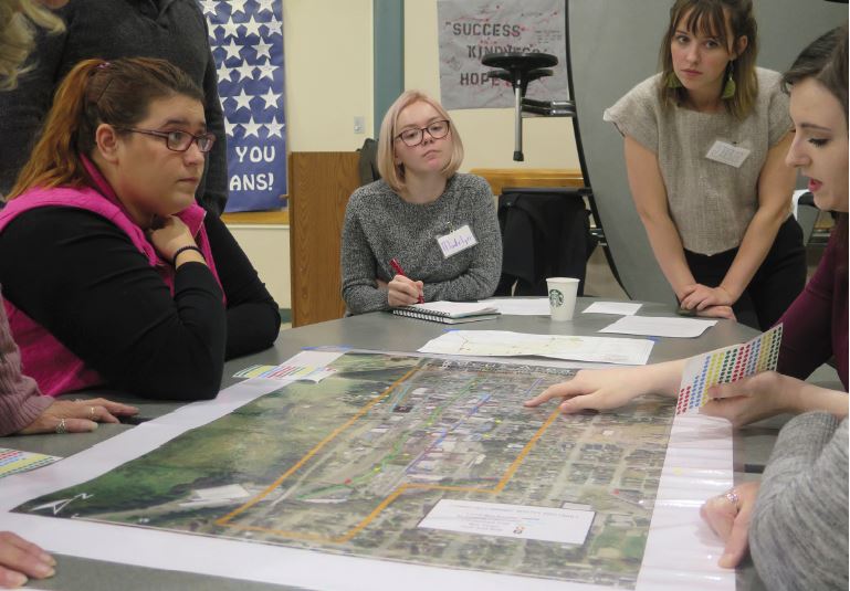
Under the guidance of Dr. Barbara Coe, students worked to understand community vision and preferences for Arlington’s downtown through the facilitation of a couple of workshops. They while also used existing data, reports, and observation to understand existing conditions. The results of this initial work were used to inform the next phase of the project, which focuses on developing alternatives (ENVS 470, Fall 2019).
The winter quarter urban planning studio course (ENVS 472), taught by Dr. Nicholas Zaferatos, incorporated urban planning principles into a series of planning alternatives to guide the development in Arlington’s Downton Corridor Plan. These include: vision for city center improvements through a community workshop; capacity for urban infill of underutilized parcels; architectural and built environment character study; city center public improvements; design guidelines; use of rights of ways and other public assets for human scale-oriented purposes; evaluation of traffic patterns, street, parking, biking, and pedestrian systems and improvements; enhancement opportunities for improved use and access to public spaces; and alternative recommendations for a city center land use subarea plan as an element of the Arlington Comprehensive Plan. Planning concepts reflect community visions, goals, and urban design principles, including Smart Growth, Sustainable Design / LEED ND, and other New Urbanism strategies.
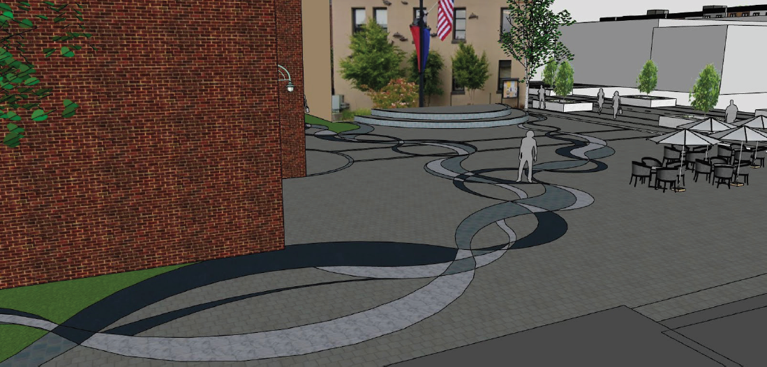
This project identified implementation strategies for design concepts developed in winter quarter. Working with community input and city staff guidance, student teams addressed the following strategies for implementing planning concepts for the Downtown Arlington Corridor: 1) regulatory reforms to support the area’s historic character and buildings, and enhance the sense of place, 2) public and private investment opportunities, 3) development incentives and opportunities, 4) infrastructure and mobility improvements, and 5) phased development plan.
This project was completed spring of 2020 by two senior planning student interns. As part of this project, Dr. Laninga and students worked with Downtown Arlington Business Association (DABA) to understand how to qualify to become a Main Street America Accredited Member. This report highlights insights gleaned through research and conversation that may inform next steps for becoming an Accredited Member.
City of Bainbridge Island
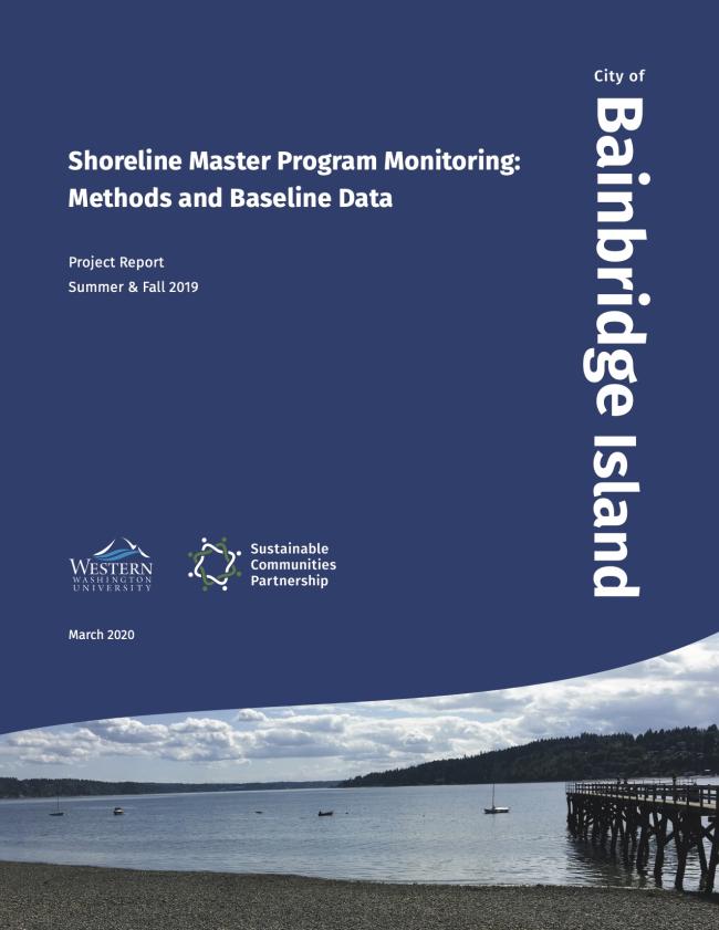
Shoreline Monitoring
Methods and Baseline Data Collection
Over the summer and fall of 2019, several WWU interns worked under the guidance of Dr. Jenise Bauman and the City of Bainbridge Island to develop a recommended shoreline monitoring methodology and to collect a baseline set of data using these methods. City employees and volunteers can use the recommended methods to add to the baseline dataset in the future.
Analysis
Students in a WWU biostatistics course taught by Dr. Robin Kodner performed statistical analyses on the baseline shoreline monitoring dataset. The City of Bainbridge Island can use the statistics and methods for analysis included in this report to monitor changes in the shoreline over time. (BIOL 340, Biometrics).
2018-2019 Partners: City of Bellingham, City of Ferndale, and City of Monroe
In the 2018-2019 academic year, SCP partnered with City of Bellingham, City of Ferndale, and City of Monroe. Six courses and two internships engaged in efforts to address sustainability needs expressed by these cities.
City of Bellingham
Whatcom County Disaster Preparedness Survey
The students in Dr. Rebekah Paci-Green’s Disaster Reduction and Emergency Planning Studio (ENVS 476, spring 2019) partnered with Whatcom County CERT volunteers to conduct door-to-door surveys of county residents, and then analyzed the responses.
City of Ferndale
The students in Dr. Tammi Laninga’s course, Land Use Regulations (ENVS 374, winter 2019), researched other jurisdictions’ downtown design regulations, compared those to Ferndale’s current code, and developed recommendations for code revisions.
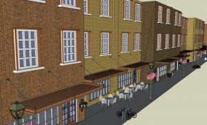
Studio II
Under the guidance of Dr. Nick Zaferatos (ENVS 472, winter 2019), students evaluated current conditions, community goals and policies, community preferences, infill development feasibility, and urban planning principles and practices, in order to develop a series of planning alternatives to guide the infill development in Ferndale’s city center.
Ferndale City Center Urban Design Plan Studio II Report
Studio III
Under the guidance of Dr. Tammi Laninga (ENVS 473, spring 2019), students worked to identify implementation strategies for design concepts developed in winter quarter’s urban planning studio course. This included regulatory reforms, development incentives, public and private investment opportunities, mobility improvement and implementation issues, and phased development plans.
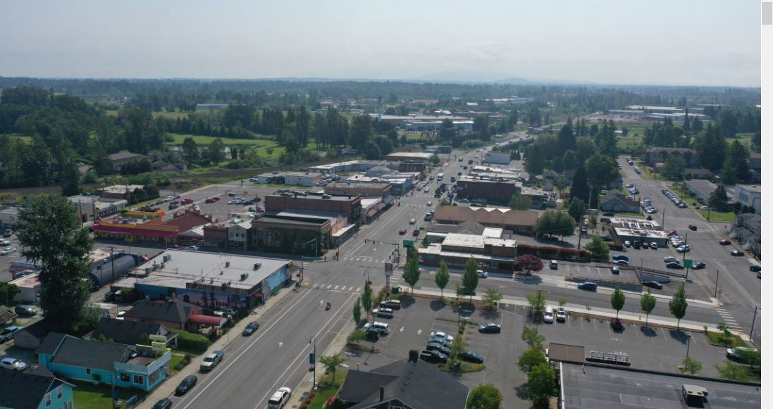
City of Monroe
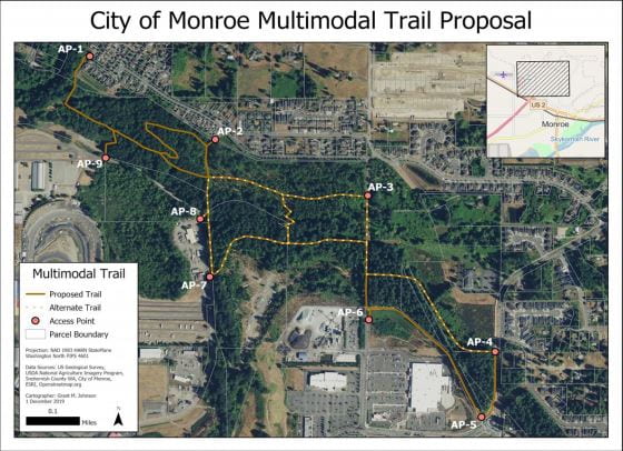
Community Engagement
Within Western’s Community Development and Participatory Methods course (ENVS 475, fall 2018), taught by Dr. Tammi Laninga, students completed conceptual trail design; multi-modal trail research; and public outreach, including hosting a public meeting and developing an interactive website.
US 2 By-Pass Trail Community Engagement Report
Transportation Analysis
Dr. Paul Stangl’s Transportation Systems and Planning course (ENVS 373, winter/spring 2019) students, as well as two students working on senior projects, completed field survey work and background research in order to 1) measure improvements to park accessibility for Monroe residents, 2) measure improvements in connectivity between complimentary land uses for pedestrians and bicyclists resulting from the US2 By-Pass trail project design, and 3) analyze pedestrian & bicycle network providing access to the trail project site.
US 2 By-Pass Trail Transportation Analysis Report
Environmental Impact Assessment
In Dr. Tammi Laninga’s Environmental Impact Assessment course (ENVS 493), students prepared an impact assessment for the US 2 By-Pass Trail area. Special attention was directed toward assessing potentially adverse impacts to critical areas.
2017-2018 Partners: Skagit County and City of Stanwood
In the 2017-2018 academic year, SCP partnered with Skagit County and City of Stanwood. Eight courses and four internships engaged in efforts to address sustainability needs expressed by the city and county.
Skagit County
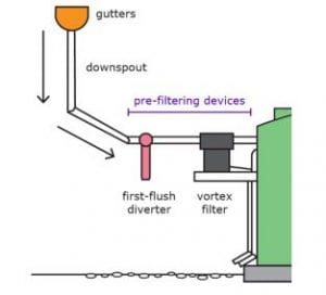
An intern worked with Dr. Robert Mitchell, a licensed hydrogeologist, to develop a rainwater catchment design template and guidance materials for homeowners. (fall, winter 2017/2018) Rainwater Catchment Design Template Report
The students in Dr. Tammi Laninga’s course, Land Use Regulations (ENVS 397J, winter 2018), researched other jurisdictions’ handling of setbacks for private roads and drafted changes to a county code.
Dr. Grace Wang worked with an intern to execute a public opinion survey designed to understand the true degree of support for various land use policy issues in the County.
This initiative is an effort to reduce water pollution that results in the closure of shellfish harvest in Samish Bay. In Assessment, Evaluation and Research in Environmental Education, a course taught by Dr. Gene Myers (ENVS 588, fall 2017), a student project team researched strategies for motivating and sustaining behavioral change to support this initiative.
By utilizing existing data and reaching out to landowners, an intern worked with Dr. Aquila Flower to identify the existence and location of septic systems around the county.
Students in Seth Vidana’s course, Campus Sustainability Planning Studio (ENVS 471, fall 2017), developed an outreach program and set of recommendations related to recycling in multi-family housing complexes, food waste reduction and/or reusing/recycling of nontraditional items like clothing.
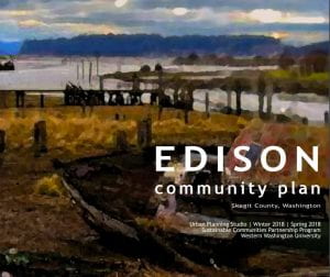
Under the guidance of Dr. Nick Zaferatos and Dr. Tammi Laninga, students wrote a community plan for Edison. The plan is based on community concerns and current needs. (ENVS 470, fall 2018; ENVS 472 winter 2018; ENVS 47s spring 2018). Edison Community Plan Report
Students in Seth Vidana’s course, Campus Sustainability Planning Studio (ENVS 471, spring 2018), addressed the largest code enforcement issue in the county, collections of obsolete machinery, car parts, appliances, and more that accumulate in outdoor spaces. The students wrote a report that included approaches taken elsewhere, recommendations for Skagit County, and outreach materials for use.
City of Stanwood
A GIS intern collected and integrated data to develop a web-based data-visualization tool. This tool allows city staff and the general public to view data relevant for flood planning by parcel/structure.
The students in Dr. Rebekah Paci-Green’s Natural Hazards Planning course (ENVS 372, fall 2017) created a website that displays results of a “SafeGrowth Audit” that revealed discrepancies between Stanwood’s Growth Management Act Comprehensive Plan and its Hazard Mitigation Plan.
Under the direction of past SCP Coordinator, David Davidson, a field crew of students used surveyor’s instruments to measure the elevation of the ground floor of every building in West Stanwood. They gathered information about the size and type of each building’s foundation and performed some face-to-face interviews.
Using data collected by the student field crew, Western’s Center for Economic & Business Research collaborated with a local contractor to determine a rough cost estimate for flood proofing measures around the city. Stanwood Financial Study Report
Disaster Reduction and Emergency Planning Studio students (ENVS 476, spring 2018) prepared a written report that assembled all of the above work in a way deemed useful by City of Stanwood staff. The course is taught by Dr. Rebekah Paci-Green.
2016-2017 Partner: City of Edmonds
City of Edmonds
(ESCI 470, fall 2016) recommended methods by which Edmonds can minimize stormwater impacts upon the Edmonds Marsh.
(ENVS 471, fall 2016) researched the means by which Edmonds might best handle food waste and construction waste. Edmonds Campus Sustainability Planning Studio Report
(JOUR 440, fall 2016) helped Edmonds promote a downtown cultural/arts corridor.
(CSCI 491, fall 2016) developed a mobile app that attracts visitors to Edmonds and informs them of attractions and events.
(ESCI 453 & 454, winter & spring 2017) evaluated environmental risks associated with a land parcel that Edmonds might soon acquire.
(RECR 373, winter 2017) helped Edmonds chart a path toward participation in the “Playful City USA” program, which seeks to promote the health of our nation’s youth.
(ENVS 476, spring 2017) analyzed the impacts of rising sea level on Edmonds.
Edmonds Disaster Reduction and Emergency Planning Report
(ENVS 422, spring 2017) used GIS to modernize management of the Edmonds Memorial Cemetery.
Advanced Spatial Analytics Report
(MGMT 466, spring 2017) helped develop the fledgling Green Business Pledge program in Edmonds.
Edmonds Greening Business Applications Report
(ANTH 454, spring 2017) performed an assessment of walkability within a region adjacent to the Edmonds downtown core.
Participatory Action Research Report